Making adjustments to individual clouds in a merged project is not an option for this workflow. Once you merge a project the individual clouds are fixed and can only be moved together. For instances that a single cloud in a merged project needs adjustment you must align your individual cloud and create a new merged project.
Best practice is to make sure you are satisfied with the alignment of all of your individual point clouds with each other, and with control BEFORE placing an order.
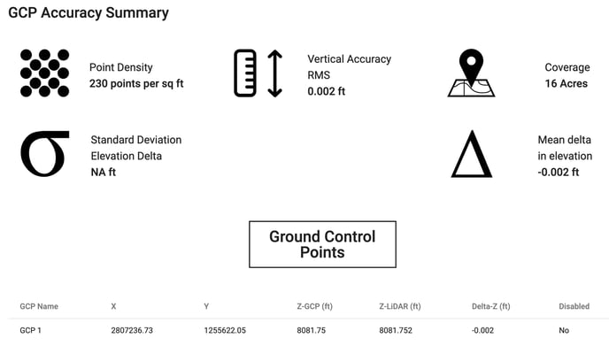
Example:
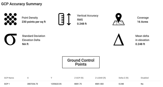
A project processed through Rock Surveyor came back with 0.248 ft vertical accuracy (RMS). Is there anything I can do to improve that?
The Delta Z value is high across the board which means that we can easily correct it by raising the entire dataset and then reprocess from the deliverables tab in ROCK Surveyor.
Note: With multiple GCPs you are going to make adjustments off the "Mean delta in elevation"
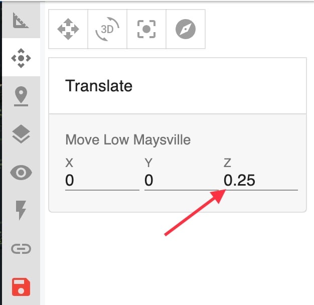
Be sure to save the visualizer after you make your translation changes!
Once that's done, the point cloud will shift accordingly, then contours will get regenerated, the DEM and then finally the accuracy report. From there you can check your accuracy report and it will give you updated standard deviations and the mean delta. If you need to do it more or less you can do this as many times as is necessary.
What if some of my points are way off from the rest?
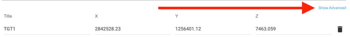
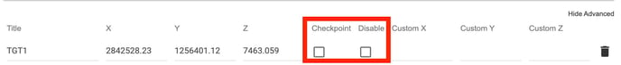
Sometimes GCPs are collected on places like the edge of curbs or areas where there is a notable vertical difference from one level to another. In these instances it is advisable to "disable" or make "checkpoints" these types of points so they don't throw off your overall RMS of your GCPs when using your "Mean delta in elevation" value to make adjustments.