How to use a Combined Scale factor to convert from Grid to Ground.
When we are making measurements on the earth's surface - for example using a total station or an GNSS receiver - we are measuring on the ground, and this is where we want our final data and numbers to exist.
It is important to have an understanding of the tools we are using to make these measurements. Because the GNSS is going to use a global coordinate system which relies on a reference ellipse, we will need to project our data to get to our final ground measurements.
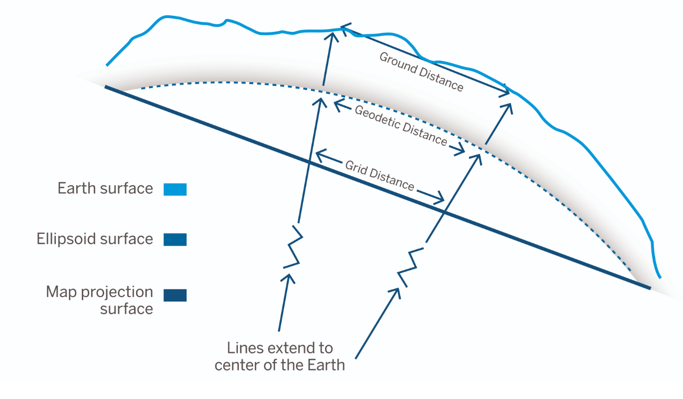
The ellipse used in GNSS measurements is a spheroidal approximation of the earth's surface works great to cover the entire globe, but it won't do us much good when we need to have our measurements written up on a flat piece of paper for our construction crew. So we will need to project our spheroid onto a flat Grid, the map projection surface (State Plane).
These Grids (state plane) are yet again another approximation. It is a flat surface where the ellipsoid is projected down onto. You can see in the first diagram, the curved ellipsoid surface will be projected onto the flat map projection surface. As you can imaging the distances measured on the projected surface, called the grid distances will not be consistent with distances measured on the ellipsoid, called geodetic distances, and what we finally want - our earth's surface (Ground distance) will yet again be another distance.
So the name of the game is to go from our measurement system in the ellipsoidal reference frame to a Map projection (Grid) and then to the earth's surface (Ground). We will do this by using the Rock clouds reprojection tool which includes all the global projections as well as the map projections found around the globe, then add our own combined scale factor to make the final conversion to our local earth's surface.
Combined Scale Factor
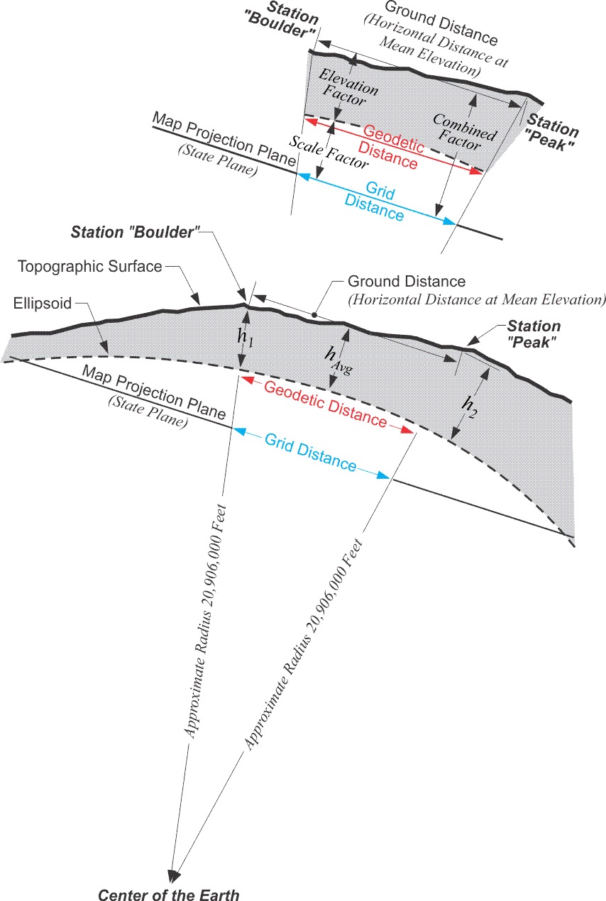
The combined scale factor is a multiplication factor that is used to convert from Grid to Ground distances. In the diagram below you can see where the combined scale factor takes us from grid distances to ground distances. There are other scale factors to convert directly from ellipsoidal geodetic distance to ground and from geodetic distance to grid distances. But here we will focus on the Grid to Ground conversion.
Here is a good video that is simple to follow on the subject -->.
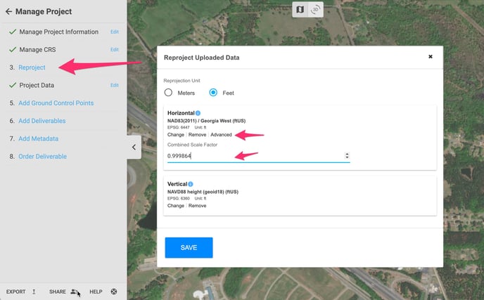
How to use a combined Scale Factor in Rock Cloud
To use a combined scale factor in the Rock Cloud to convert from Grid to Ground
- use the Reproject section under Manage project.
- Select your Reproject units, meters or Feet.
- Find your map projection (State Plane).
- Click on advanced and here you can add your combined scale factor.
- Save and wait for your reprojection.