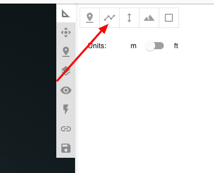
For Vegetation Management deliverable, you will need to select your center line. To do this, first use the line tool to draw a reasonably close center line along your utility poles.
Note: It does not need to be perfect. As long as it marks the length of the corridor you will be good.
Once the centerline is drawn, then use the following icon to mark this measurement as the centerline.
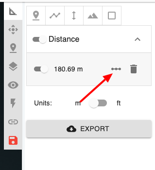
Tip: You can use multiple centerlines in a single project if you have more than one sections of power lines.