- ROCK Knowledgebase
- ROCK Cloud
- Project Data
How do I upload my orthomosaic to view on the Rock Cloud?
Export a geotiff in 8-bit 3 band RGB format.
Step 1: Download your orthomosaic in geotiff format.
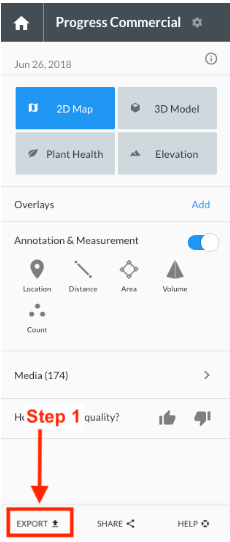
Drone Deploy
Create an export with the following settings:
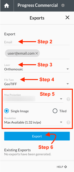
In Step 5 be sure to select the same projection as your LiDAR data.
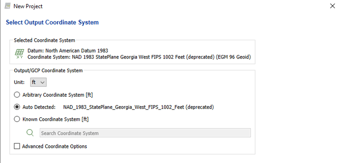
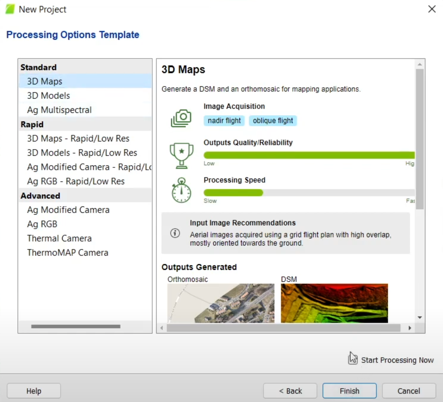
Pix4d
1. In the project setup, make sure to select the coordinate system to match your Rock Cloud Project.
2. Select 3D Maps
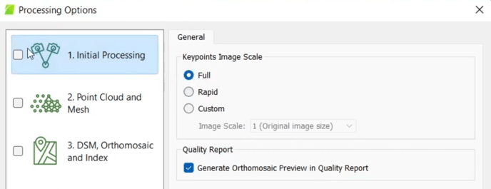
3. Select "Full" for Keypoints Image Scale
4. Upon completion of processing, upload the ortho in TIFF format to Rock Cloud
Other
Export a geotiff in 8-bit 3 band RGB format.
The format needs to be geotiff, not jpeg, pdf, etc...
Step 2: Upload to the Rock Cloud in your "Project Data"
Uploading an Orthomosaic to your ROCK Cloud Project can be a useful visual for customers and also will be used in assisting with processing your ROCK Cloud Deliverables such as Planimetrics!