 In this article, we'll dive into the key concepts of LiDAR intensity, including reflectivity and return, and explore how they play a role in creating accurate point clouds.
Reflectivity
Reflectivity refers to the ability of a surface to reflect the laser pulse that LiDAR sends out. The reflectivity of a surface can impact the strength of the return signal, which is the signal that the LiDAR sensor receives after sending out a laser pulse. Highly reflective surfaces, such as water or metal, will have a stronger return signal than less reflective surfaces, such as vegetation or soil.Return
Return refers to the signal that the LiDAR sensor receives after sending out a laser pulse. The strength of the return signal can vary depending on the reflectivity of the surface and the distance to the surface. LiDAR sensors can measure multiple returns from a single pulse, allowing for the creation of 3D point clouds representing the Earth's surface.Point Clouds
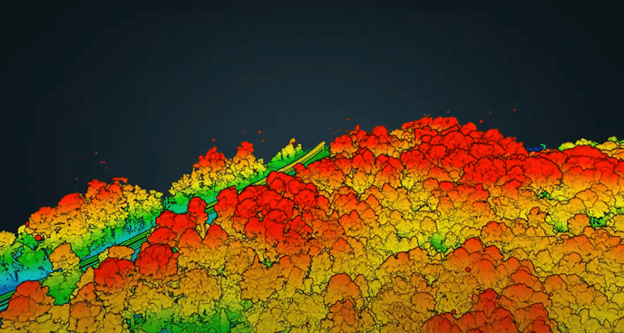
Point clouds are a collection of 3D points representing the Earth's surface. These points are created by measuring the return signal from multiple laser pulses. The strength of the return signal, as well as the reflectivity of the surface, can impact the accuracy of the point cloud. Points with a strong return signal will be more accurate than points with a weak return signal.Temperature and Humidity
Temperature and humidity can significantly affect LiDAR intensity. The laser pulse that LiDAR sends out travels through the atmosphere, and the temperature and humidity can cause the laser pulse to scatter and weaken the return signal.
Temperature plays a role in LiDAR intensity by affecting the density of the air. As the temperature increases, the density of the air decreases, causing the laser pulse to scatter more. This can lead to a weaker return signal and a decrease in LiDAR intensity. On the other hand, as the temperature decreases, the density of the air increases, causing the laser pulse to scatter less. This can lead to a stronger return signal and an increase in LiDAR intensity.
Humidity also plays a role in LiDAR intensity by affecting the amount of water vapor in the air. As the humidity increases, the amount of water vapor in the air also increases, causing the laser pulse to scatter more. This can lead to a weaker return signal and a decrease in LiDAR intensity. On the other hand, as the humidity decreases, the amount of water vapor in the air also decreases, causing the laser pulse to scatter less. This can lead to a stronger return signal and an increase in LiDAR intensity.
This means that LiDAR intensity can also vary greatly depending on the location and time of day. LiDAR data users need to consider the atmospheric conditions when planning surveys and interpreting the information to ensure that the data is accurate. By keeping these factors in mind, you can dial in your point cloud data to get precision accuracy for your LiDAR surveying projects.
Visit rockrobotic.com to learn more about ROCK Robotic's survey-grade LiDAR hardware and software.