So for one reason or another, sometimes we need to get access to alternative base station data. This could be because you knocked over the base station, it didn't record, or for any number of reasons. One way to get this data is by downloading the RINEX data from a CORS base station. Here is how you do it.
Step 1: Identify a base station nearest to your project. To do this we will use the CORS map provided by NOAA and find a 1-second station. Usually we want this base station to be within 30km of your project area.
Here → CORS Map
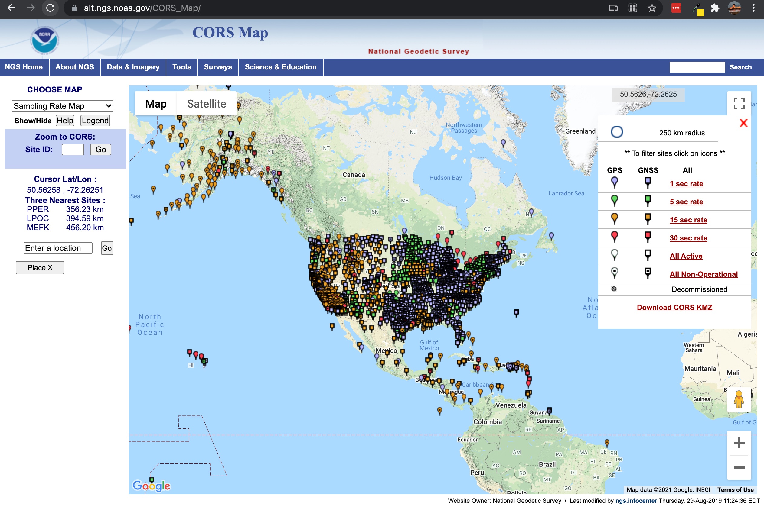
Here is an example of a good choice
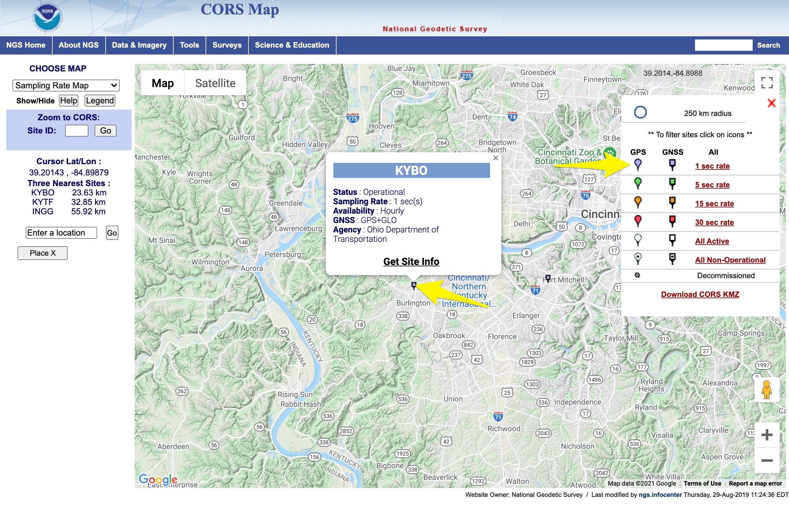
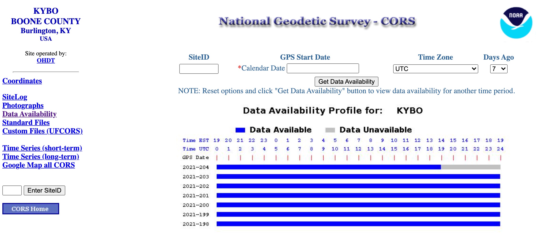
Identify the call signal for this station. In this case it is KYBO
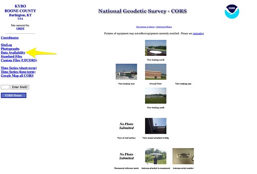
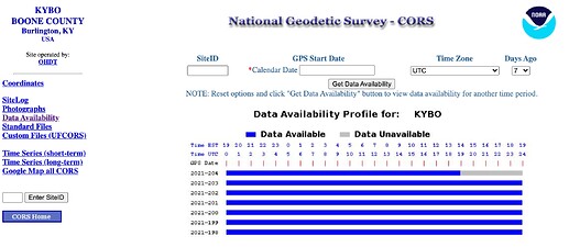
- Often these stations can take 24 hrs to upload the latest RINEX data to the server. So you can check the data availability. To do this, click on the Get site info and then on the site info click the Data Availability. You can see that most of today's data is already available
- Now let's go get that RINEX data.
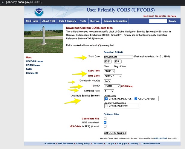
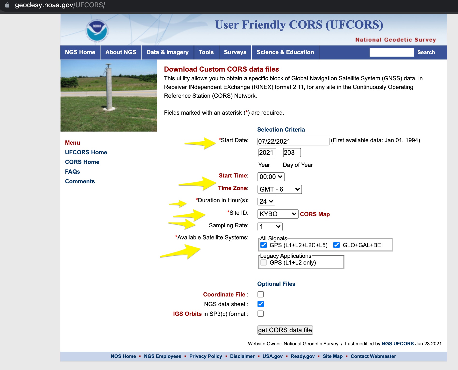
a. Go to the USER friendly CORS data download site
Here → National Geodetic Survey - User Friendly CORS v4.0
b. Enter in your start date, start time, Time zone, duration, site ID, 1 second sampling rate, select ALL signals, and if you want you can grab that site data sheet as well. This will have all the information about the precise location of that base station. Then select get CORS data file
There you go! Now you have a RINEX 2.11 version raw observation! Happy processing