R2A Specifications
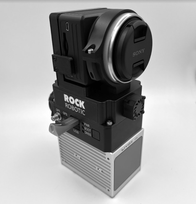
The ROCK R2A combines a Livox LiDAR and 24MPx camera with a high performance IMU/GNSS.

Accuracy
- +/- tenth of a foot RMSE @ 200 feet above ground
- +/- 3 centimeter RMSE @ 60 meters above ground
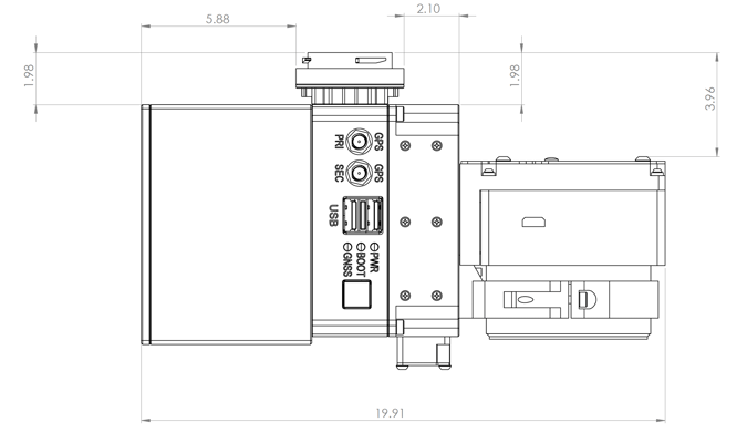
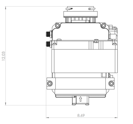
Dimensions
- 7.9" x 3.7" x 4.8" (L x W x H)
- 20cm x 9cm x 12cm
Weight with camera
- 2.7 pounds
- 1200 grams
Storage
- 256GB included
- Supports up to 1TB
- USB 3.1 400MB/S
Wi-Fi
- 802.11 b/g/n
External Power Input
- 9 - 36V DC Nominal 24 Watts
Peak at cold start 36 Watts - Reverse-Polarity Protected
- Skyport or XT60 for power
Laser Sensor
- Livox Avia
- Wavelength 905nm
- Safety Class 1 Eye Safe
- Scan Range 190m @10% reflectivity
230m @20% reflectivity
320m @80% reflectivity
- Field of View 70.4° (Horizontal)
4.5° (Vertical) - Precision 2cm
- Point Rate 240,000 points/s one return, first/strongest
480,000 points/s two return
720,000 points/s three return - Temperature -20˚C to 65˚C
- IP Rating IP67
IMU
- Attitude Accuracy Pitch/Roll 0.006°
Heading 0.03° - Position Accuracy 0.5cm (PPK)
1cm + 1ppm (RTK)
Navigation System
- High Performance GNSS GPS / GLONASS / BeiDou / Galileo
RGB Camera
- Sony A5100 24MPx
Focal length camera lens 16mm
GNSS Antenna
- Tallysman HC977
Drawings

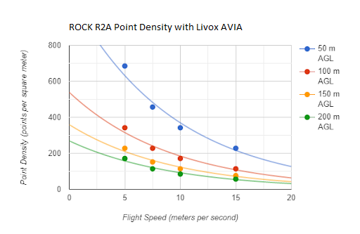
Point Density Chart
 Documents
Use the navigation menu below to continue the tutorial.
|
Previous |
ROCK R2A Tutorial |
![ROCK-robotic-community-logo.png]](https://learn.rockrobotic.com/hs-fs/hubfs/ROCK-robotic-community-logo.png?width=250&height=50&name=ROCK-robotic-community-logo.png)