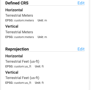
Terrestrial data when initially processed is in an arbitrary coordinate reference system where 0,0,0 is where the scanner was positioned and the dataset will be in meters.
If you need to reproject this dataset into feet for further processing simply select the following Defined CRS and Reprojection: