The ROCK Ultra LiDAR system is optimized for high-precision aerial surveying. The key factors influencing point density are flight height, aircraft speed, and pulse repetition rate (PRR).
The ROCK Ultra LiDAR system is optimized for high-precision aerial surveying. The key factors influencing point density are flight height, aircraft speed, and pulse repetition rate (PRR). This article provides recommended configurations to achieve a target point density based on flight parameters.Understanding the Relationship Between Speed, Height, and Point Density
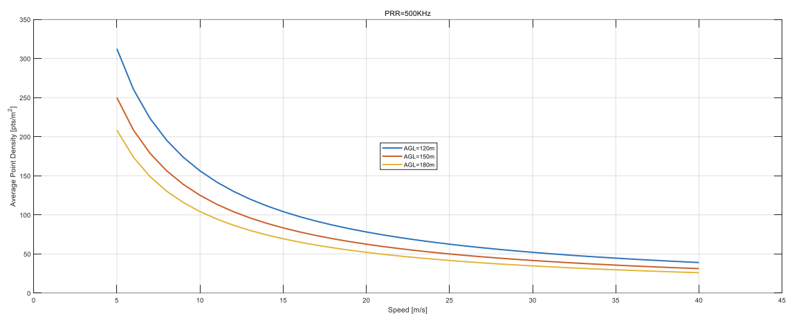
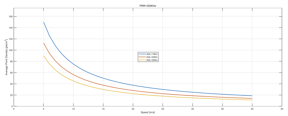
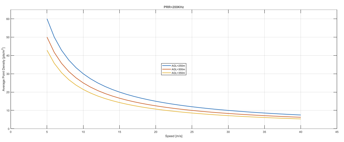
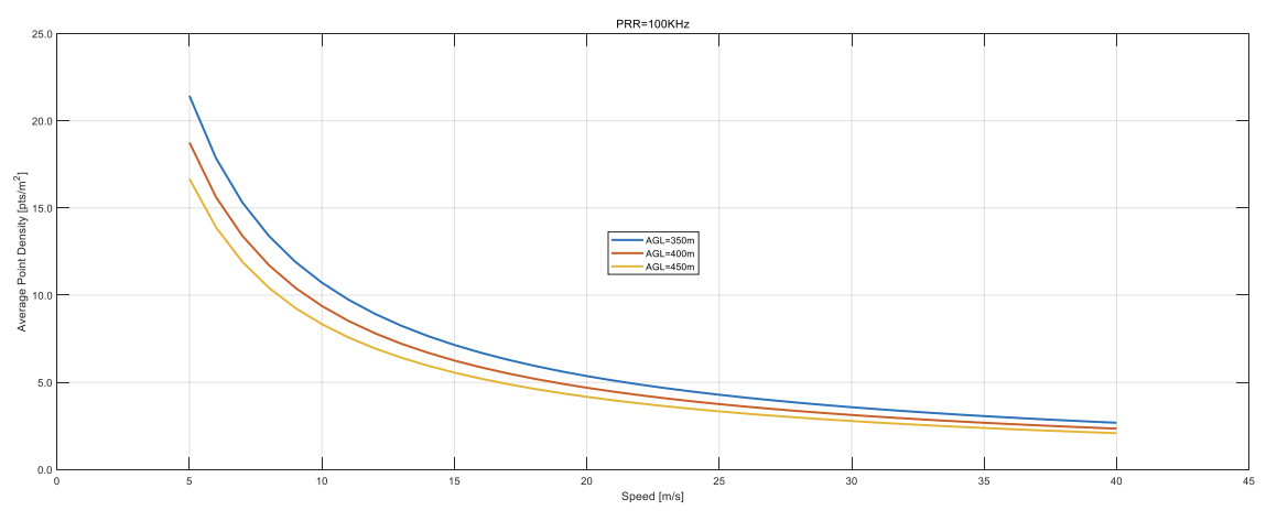
The provided graphs (which will be pasted below) illustrate how the point density varies with different speeds, altitudes, and PRR settings. Below is a summary of the insights:
- Higher flight altitudes result in lower point densities, as the laser footprint covers a larger ground area.
- Slower aircraft speeds increase point density, since more laser pulses are concentrated in a given area.
- Higher PRR values lead to higher point densities, as more pulses are emitted per second.
Graph Analysis: Speed vs. Point Density at Different Heights
The graphs demonstrate how varying speed at different heights affects the achieved point density:
-
Low Altitude (e.g., 50m-100m)
- At lower altitudes, the laser pulses are more concentrated, resulting in higher point densities.
- Even at higher speeds, a sufficient density can be maintained due to the shorter beam divergence.
-
Medium Altitude (e.g., 100m-200m)
- The point density begins to drop as altitude increases.
- Speed plays a crucial role; reducing speed significantly improves point density.
-
High Altitude (e.g., 200m-300m)
- At high altitudes, the point density reduces considerably.
- Even at slower speeds, achieving a high-density scan may require increasing the PRR.
Recommended Flight Configurations for Desired Point Density
Below are general guidelines based on the provided graphs:
| Altitude (m) | Speed (m/s) | PRR (kHz) | Estimated Point Density (pts/m²) |
|---|---|---|---|
| 50 | 5 | 1000 | Very High (ideal for urban surveys) |
| 100 | 7 | 1000 | High (suitable for infrastructure mapping) |
| 120 | 7 | 500 | Moderate (suitable for general mapping) |
| 200 | 8 | 200 | Lower (forestry & large-area mapping) |
| 250 | 8 | 100 | Sparse (suitable for regional surveys) |

Key Takeaways
- For high-density scans, fly at lower altitudes with slower speeds and high PRR.
- For efficient large-area coverage, fly at higher altitudes and adjust PRR accordingly.
- Balancing speed and PRR is crucial—high speeds reduce density, but increasing PRR can compensate.
Conclusion
Selecting the appropriate flight parameters is essential for achieving the desired point density with the ROCK Ultra LiDAR system. The provided charts offer a reference to adjust speed, altitude, and PRR settings to meet different surveying needs.