Here will discuss why GCPs are essential in aerial surveying projects and how they improve the overall quality of your final project deliverables.
What are Ground Control Points?
GCPs are a set of points on the ground that have known coordinates. They are used as reference points in aerial surveying projects to ensure that the final product is accurate and precise. GCPs are typically marked with a small monument or other identifiable feature, such as a flag or paint mark.
Why are Ground Control Points Important in Aerial Surveying Projects?
-
Improve Accuracy:
When using LiDAR, GCPs can be used to precisely align the data collected by the sensor with the ground coordinates. By using GCPs, the sensor's position and orientation can be accurately determined, which improves the accuracy of the data collected.
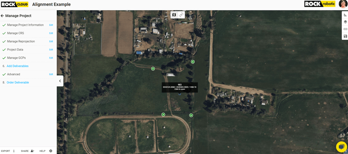
In addition to aligning the data with ground coordinates, GCPs can also be used to validate the accuracy of the data collected. By comparing the location of the GCPs in the data to their known locations, the accuracy of the data can be determined. This allows for any errors or inaccuracies in the data to be identified and corrected, which further improves the overall accuracy of the survey. GCPs are particularly important when working in areas where there is limited ground control, such as remote or densely forested areas, as they provide a reliable reference point to ensure the accuracy of the survey data. ROCK Cloud's Auto-Align GCP tool allows you to adjust your GCPs to give them pinpoint accuracy.
-
Reduce Errors: Using GCPs allows for the identification of systematic errors, such as sensor biases and distortions, which can be corrected through post-processing. This helps to reduce errors and improve the overall accuracy of the survey data.
-
Facilitate Quality Control: GCPs also facilitate quality control, allowing for easy and accurate verification of the final product. This can help to ensure that the final product meets the necessary standards and specifications.
By incorporating GCPs into the surveying process, your aerial surveying projects can be completed with greater confidence and efficiency, and your clients will get great deliverables.