Adding Project Data
To upload file to your Project Data in ROCK Cloud, you will need to click on "Manage Project" in the upper left, then click on "Add Project Data". A Manage Data Box will appear with "Data" and "Photos" tabs that can be used to upload data.
LiDAR
The ROCK Cloud supports .las, .laz., .e57, .pts, and .ply files. LAZ files are compressed and lossless LAS files. The compression of these files can be extraordinary. We recommend that all .las files be converted to .laz files prior to upload. If converted prior to upload, there will be a substantial savings in upload time and cloud storage space used.
See how to compress your .las using ROCK Desktop HERE.
GeoTIFF
Upload a GeoTIFF (.tiff or .tif) file into the "Data" tab for it to display on the map view. This can be an orthomosaic, DEM, or any other type of GeoTIFF. We will process these files to ensure they load quickly on the map view.
Be sure the GeoTIFF is in the correct projection. It will need to be in the source CRS projection (WGS84 UTM Zone XX N/S meters) for your dataset.
Contours
Upload a shapefile into the "Data" tab. We will process and display the contour information on your map and LiDAR view.
Be sure to upload all of the appropriate shapefile files and they all have the same name. (.shp, .dbf, .shx (optional), .cpg (optional). For instance:
contour.shp, contour.dbf, contour.shx, contour.cpg
Planimetrics (points, lines, and polygons)
Upload a shapefile into the "Data" tab. We will process and display the points, lines, and polygon information on your map and LiDAR view.
Be sure to upload all of the appropriate shapefile files and they all have the same name. (.shp, .dbf, .shx (optional), .cpg (optional). For instance:
planimetric.shp, planimetric.dbf, planimetric.shx, planimetric.cpg
KML/KMZ
Upload a KML/KMZ file into the "Data" tab. We will process and display the kml information on your map view.
It is expected that your KML/KMZ data is in WGS 84 (EPSG: 4326). We will reproject this information to display on your map appropriately.
Photos
Upload .jpg photos to the "Photos" tab. If these photos contain lat/long exif data they will display on your map view.
Trajectory
Upload R2A trajectory file to the "Data" tab to display the trajectory on your Map and LiDAR view.
Be sure the trajectory contains the word "trajectory", "ppk.txt", or "-traj".
Other File Types
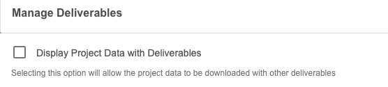
Other valid file types are: .txt, .gzip, .cmd, .pcmp, .rtcm3, .gps, .imr, .livx, .pos, .img, .pcpp, .shp, .dbf, .cpg, .prj, .shx, .e57, .pts, .ply, .zip, .kml, .kmz, .xyz, .scan, .out, .tif, and .tiff. If you upload these files they will be displayed on the Deliverables sidebar if "Display Project Data with Deliverables" is checked within the "Add Deliverables" modal.