Exporting a DXF
- Ensure you are satisfied with your project data's alignment by aligning your pointcloud to the GCP's. See aligning your project to GCP's.
- Order the ROCK Surveyor by following these steps: Ordering ROCK Surveyor.
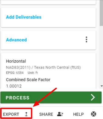
- Once your Surveyor order is complete (you will receive an email), click "export" on your project dataset.
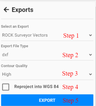
- (Step 1) Select either "ROCK Surveyor Vectors" or "ROCK Surveyor Grid" under the Select an Export menu. Vectors are your contours and Grid is points in a grid size of your choosing.
- (Step 2) Select "dxf" under the Export File Type menu.
- (Step 3) Select "contour quality" (if you chose "vectors" as the export) or "grid size" (if you chose "grid" as the export).
- (Step 4) If you'd like to reproject your vectors to WGS 84 instead of using your project CRS or Reprojection click the checkbox. (Option will not appear for "grid" export type).
- (Step 5) Click "export.
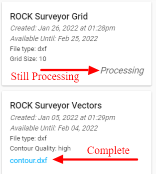
- Once your file is completed you will see it in "available exports" and the card will show the file link instead of "processing"