Reprojection allows you to take your collected data and order accurate deliverables.
Remember that will have previously defined your CRS (the projection your lidar data was captured in) prior to this step.
R2A Users click here for more information
DJI L1 Users click here for more information
Setting Your Reprojection
If you need your deliverables in state plane, a local projection system, or in units other than meters you WILL need to reproject your data.
Follow these Steps:
1. Locate the "Reproject" tab (item #3 in the Manage Project checklist) in your new ROCK Cloud project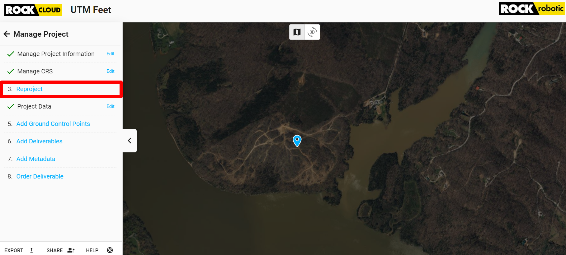
2. Select the unit your reprojection system is in (feet or meters).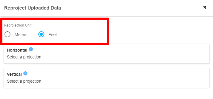
3. Select the Horizontal datum by clicking "Select a Projection" in the Horizontal box and either using a suggested option or manually searching with text or EPSG code.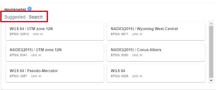 4. Select the Vertical datum by clicking "Select a Projection" in the Vertical box and either using a suggested option or manually searching with text or EPSG code.
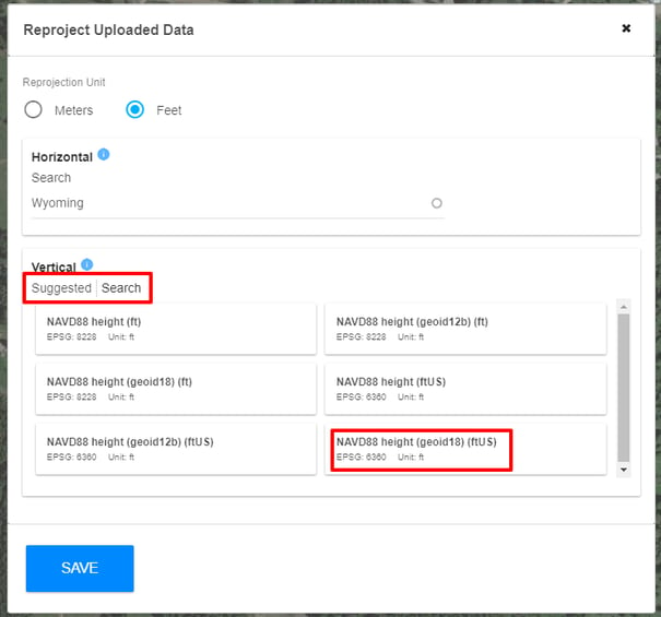
Pay special attention to the Projection Unit at the top of the box as well as ft vs ftUS in the unit type (if using feet).
Use the navigation menu below to continue the tutorial.
|
ROCK Cloud Tutorial |
ROCK Cloud Tutorial |